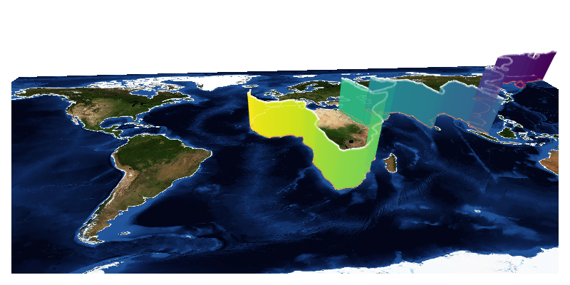
vertical 3d band over map

julia
using GLMakie, GeoMakie
using Downloads: download
using FileIO
GLMakie.activate!()

earth_img = load(download("https://upload.wikimedia.org/wikipedia/commons/5/56/Blue_Marble_Next_Generation_%2B_topography_%2B_bathymetry.jpg"))

fig = Figure(; size=(800, 400), fontsize=22)
ax = LScene(fig[1,1])
lines!(ax, GeoMakie.coastlines(), transparency=true)
lines!(ax, GeoMakie.coastlines()[95], color=:red, linewidth=5, transparency=true)
image!(ax, -180..180, -90..90, earth_img'[:,end:-1:1])
fig

idx_l = findmax(length.(GeoMakie.coastlines()))
longpath = GeoMakie.coastlines()[idx_l[2]]
@show idx_l


linepath = Point3f[]
for p in longpath.points
    push!(linepath, Point3f(p..., 0))
    push!(linepath, Point3f(p..., 0))
end

linepathh = Point3f[]
for p in longpath.points
    push!(linepathh, Point3f(p..., 20))
    push!(linepathh, Point3f(p..., 20))
end

fig = Figure(size=(800, 400), fontsize=22)
ax = LScene(fig[1,1]; show_axis=false)
lines!(ax, GeoMakie.coastlines(), transparency=true, color=:white)
lines!(ax, linepath, color = :orangered, linewidth=2.5, transparency=true)
lines!(ax, linepathh, color = :white, linewidth=2.5, transparency=true)
band!(ax, linepath, linepathh, color = repeat(1:1386, outer=2), transparency=true)
image!(ax, -180..180, -90..90, earth_img'[:,end:-1:1])
rotate!(ax.scene, 2*pi/2.6)
fig
zoom!(ax.scene, cameracontrols(ax.scene), 30)
# center!(ax.scene)
idx_l = (693, 95)